Changes to Mýrdalsjökull ice cap
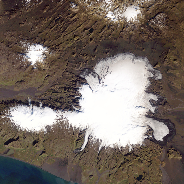
Mýrdalsjökull in 1986 photo/ NASA
Mýrdalsjökull glacier, south Iceland, has undergone considerable changes in the past 28 years. NASA's home page shows two satellite photos of the glacier, the former taken on September 16th 1986 and the latter on September 20th 2014. The images clearly show how much the ice cap has receded.
NASA explains that some melting has been caused by volcanic actiity beneath the surface of the glacier and that ablation has exposed brown bands of ash that were deposited by past eruptions. Mýrdalsjökull lies above the Katla volcano.
"Not all of the differences between the images are associated with volcanic activity. In 1890, Iceland's glacier coverage peaked for the first time since the end of the Ice Age. Since that peak, however, rising temperatures led many of the region's glaciers to begin retreating. A cooler climate in the 1940s allowed some glaciers to briefly advance, but since the 1990s, the pattern has been steady retreat."
The NASA website interviews geophysicist Þröstur Þorsteinsson at the University of Iceland who points out that Katla is due for an eruption. Located at Iceland's southern tip, Katla erupts about twice per century, with the last confirmed eruption in 1918.
"Katla has been ’due’ for a while now," said Throstur Thorsteinsson of the University of Iceland. "There have been episodes of seismic activity, but still no big eruptions." There have been occasional signs of small glacial outburst floods, called jökulhlaups, an indication that small events may be occurring below the ice cap, he said, "but nothing has been well confirmed."
Glaciers in Iceland have been receding at a steady rate since 1990 because of global warming.
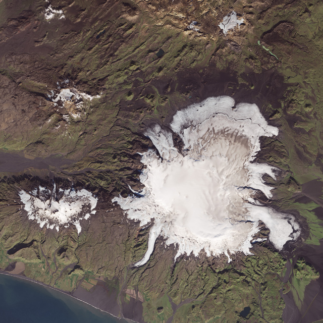
Mýrdalsjökull in 2014 Photo/ NASA