Weather warning for tomorrow
Travel conditions will be poor in the south and west of the country tomorrow. mbl.is/Björn Jóhann
Two low pressure systems are forecast to reach Iceland during the period from Friday morning until Saturday evening. The forecast is for southeast 20-25 m/s, (strong gale to storm) tomorrow, Friday, but south 25-30 m/s (storm to violent storm) on Saturday. A heavy rainfall warning has also been issued for these lows.
Travel conditions will be poor in the south and west of the country tomorrow due to wind and rain. On Saturday, wind conditions will be even worse, making travel very dangerous throughout the country until Saturday evening.
Warning
Strong gale to storm, mean wind speed of 20-25 m/s, is forecast in Iceland tomorrow, Friday. Violentstorm (up to 30 m/s) in the western half on Saturday but strong gale to storm (20-25 m/s) in the east. Warnings of heavy precipitation and rapid thaw in the southeast and the south tomorrow but effecting the whole country on Saturday.
Because of recently fallen snow there is a danger of flooding of rivers and streams, and slush- or mud floods. Also there is a danger of wet snow avalanches. This kind of
event happens once every several years.
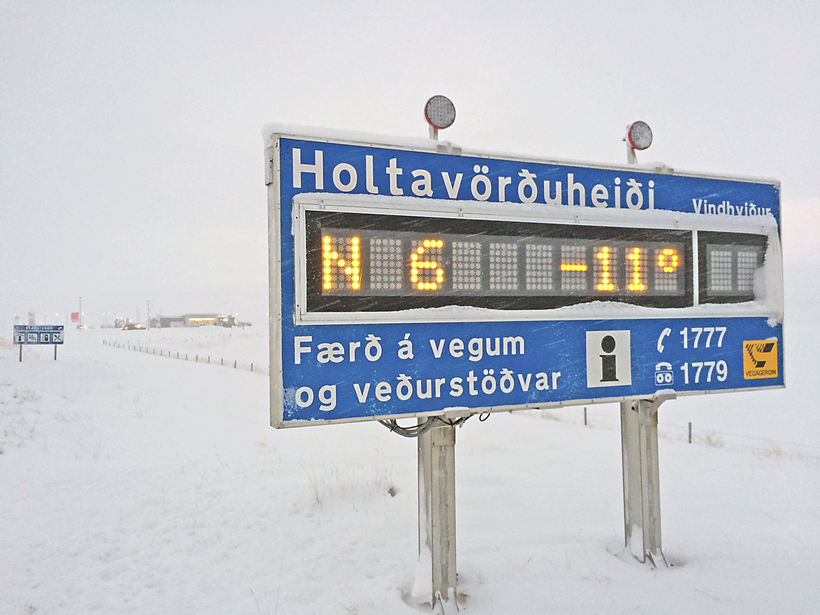
The forecast for tomorrow, 13. March: Increasing SE winds in the morning, 18-25 m/s past noon in the south and the west but 15-23 m/s in the east in the evening. Sleet and later rain, heavy in the southern half. Decreasing wind and preciptiation in the evening, first in the west. Temperatures increasing to + 3 to +8 °C by evening.
Forecaster’s remarks: This evening there will severe gale (more then 20 m/s) along the south coast but over Iceland tomorrow. Heavy precipitation in the south and the southeast next two days. On Saturday expect even worse weather over the whole country the whole day. Travelling may be very dangerous.