Still no signs of eruption
Bárðarbunga status
- Civil Protection level was raised to Alert Phase on August 19th. Following seismic activity in Bárðarbunga in the last few days
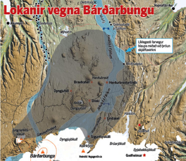
- The area north of Dyngjujökull has been closed and evacuated.
- Seismic activity is in the northwestern part of Vatnajökull, the main area is northeast of Bárðarbunga.
- Since midnight on August 20th, around 300 earthquakes have been detected.
- The depth of the events is similar to what it has been during the last few days.
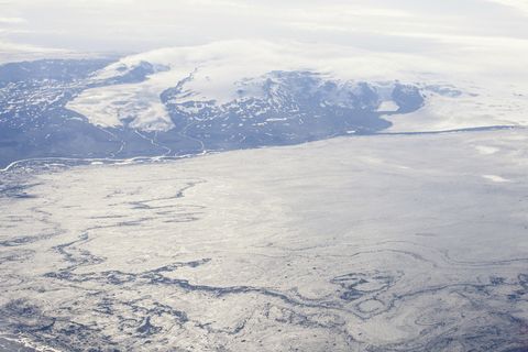
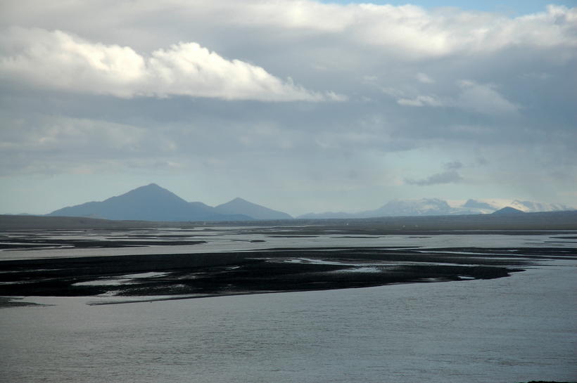
The National Crisis Centre has been fully activated after a decision was taken to evacuate the highlands north of Dyngjujökull (part of Vatnajökull glacier). The area is now closed and has been evacuated. These actions were taken following seismic activity around the Bardarbunga caldera in the last few days.
The area that has now been closed is both large in size and unpopulated. There are still no signs of eruption but these security measures have been taken since it would not be possible to evacuate the area in time should a sub-glacial outburst flood occur from Vatnajökull as a result of an eruption.
At 03.00 GMT the area had been evacuated. A map of the closed area is available at the website of the Icelandic Road and Coastal Administration: http://www.vegagerdin.is/media/umferd-og-faerd/Halendi.gif
In the northwestern part of Vatnajökull glacier the seismic activity is stable, with the main area being northeast of Bardarbunga. Over 300 earthquakes have been detected since midnight. The strongest event was of the magnitude 3.0. Another event happened inside the Bardarbunga caldera and was of the magnitude 2.7.
Today The Coast guard airplane, TF SIF, will make a surveillance flight over the area with scientists and representatives of the Civil Protection unit, if weather conditions allow. Police and ISAR units will enforce the closure of the area. The situation will continue to be closely monitored.
Bárðarbunga status
- Civil Protection level was raised to Alert Phase on August 19th. Following seismic activity in Bárðarbunga in the last few days
- The area north of Dyngjujökull has been closed and evacuated.
- Seismic activity is in the northwestern part of Vatnajökull, the main area is northeast of Bárðarbunga.
- Since midnight on August 20th, around 300 earthquakes have been detected.
- The depth of the events is similar to what it has been during the last few days.

 Fjárfestingin 115 milljarðar króna
 Ofsóttur innan veggja Boeing
 „Þögnin er ærandi“
/frimg/9/40/940831.jpg) Telur eyðsluna munu rjúka upp úr öllu valdi
Telur eyðsluna munu rjúka upp úr öllu valdi
 Kveðst tala af virðingu: „Ég er enginn dóni“
 Innviðir þandir og álagið „gríðarlegt“
 Kvikan virðist nú skiptast til helminga
 Mikil skjálftavirkni á landinu áhyggjuefni