The lava eruption on Holuhraun continues
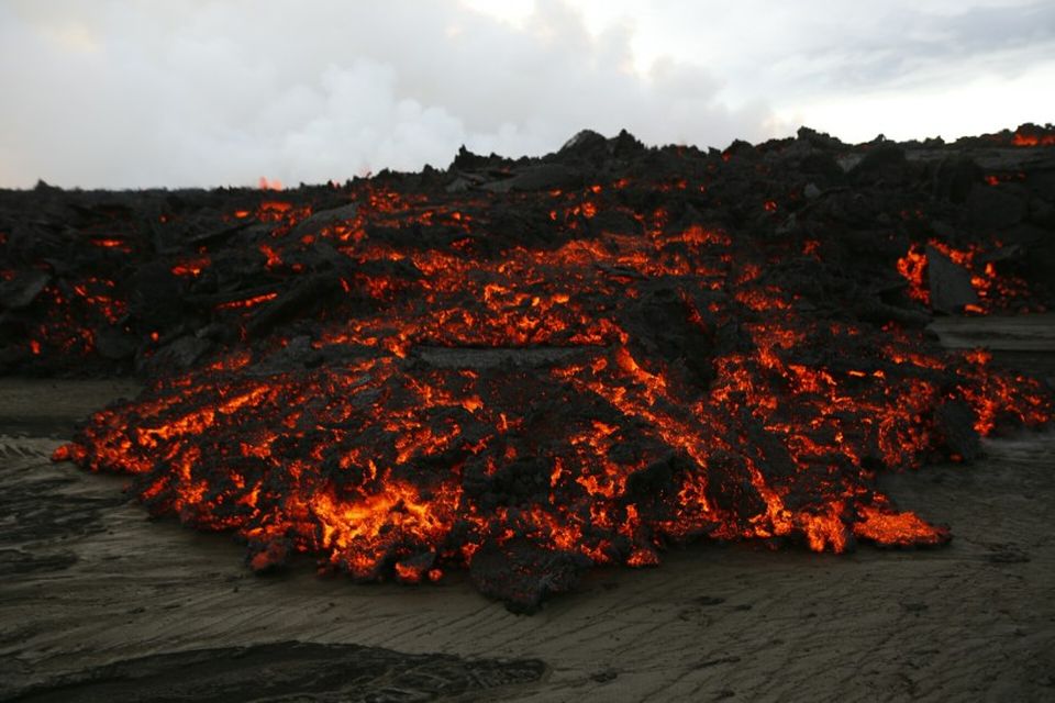
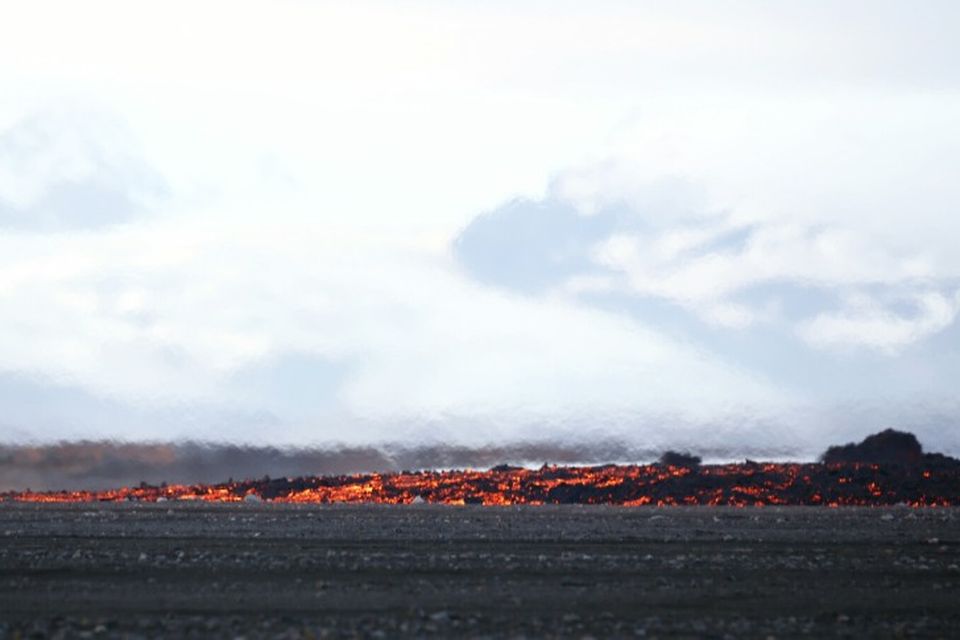
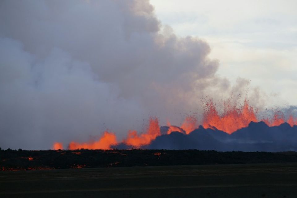
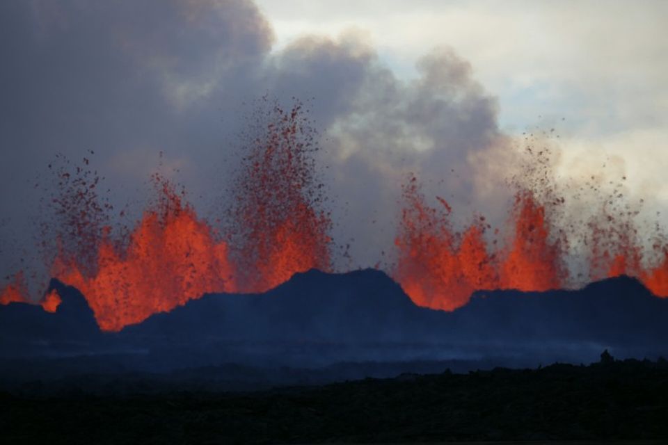
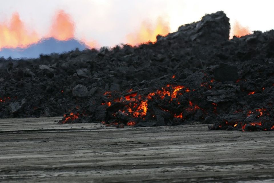
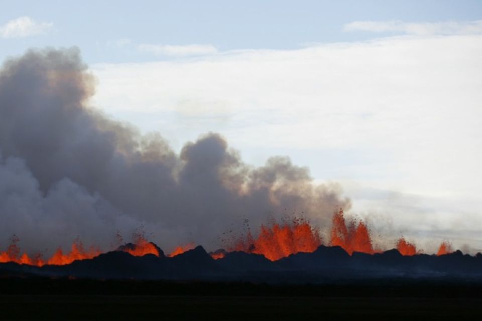
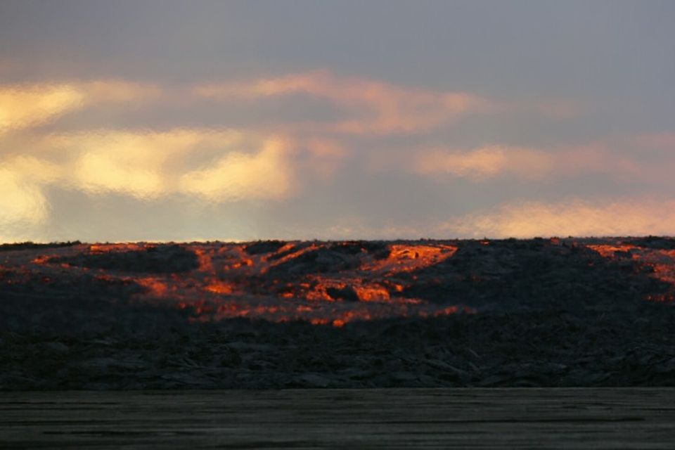


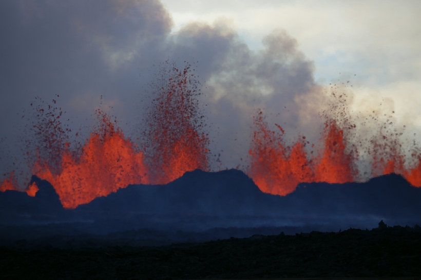
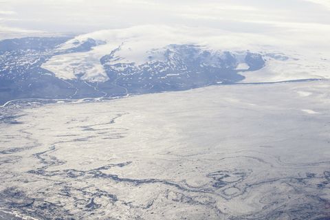
The lava eruption on Holuhraun continues. Lava flows northward from the eruption site. At 20:00 UTC yesterday, the lava extended over a 3-km-area. This corresponds to a magma discharge of 300 to 500 cubic metres per second. From observations yesterday evening, the volume of erupted lava is between 16 and 25 million cubic metres.
Conclusions of the Scientific Advisory Board of the Icelandic Civil Protection:
- The lava eruption on Holuhraun continues. Lava flows northward from the eruption site.
- At 13:00 UTC today, an overflight will be made over Holuhraun and north-west Vatnajökull with scientists from the Icelandic Meteorological Office and the University of Iceland, together with a representative from the Icelandic Civil Protection. Observations from this flight will be reported in later briefings.
At 20:00 UTC yesterday, the lava extended over a 3-km-area. This corresponds to a magma discharge of 300 to 500 cubic metres per second. From observations yesterday evening, the volume of erupted lava is between 16 and 25 million cubic metres.
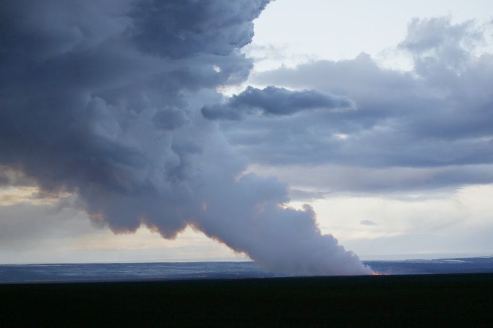
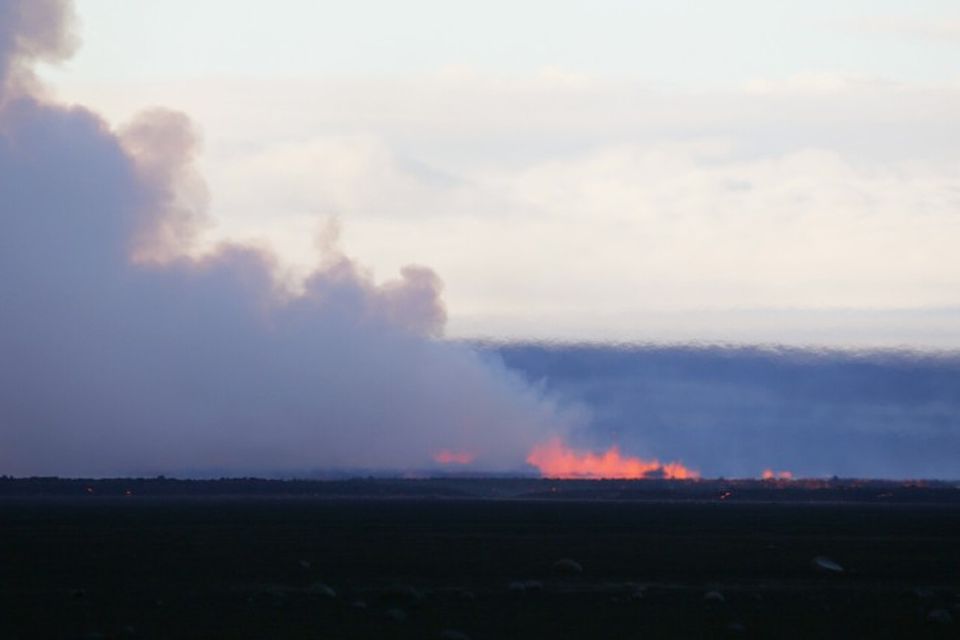
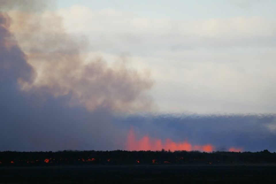
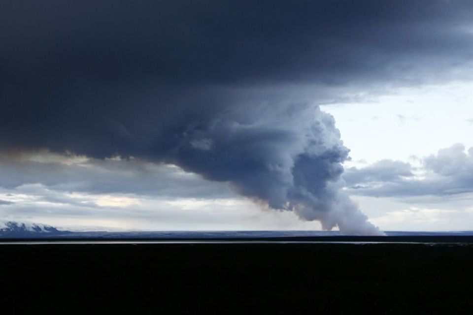
- The eruption has not created any ash-fall.
- Gas and steam rises to a couple of hundred metres above the eruption site, extending up to 1,200 m downwind.
- In connection with the FUTUREVOLC project, a gas monitoring station has been set-up near to the eruption site. Gas measurements indicate a high level of sulphur dioxide. People could be exposed to highly dangerous gas levels close to the eruption. It is essential that those visiting the eruption site are equipped with gas sensors and gas masks.
- According to the latest GPS observations, horizontal ground movements continue in response to the dyke intrusion. There is no clear sign of a pressure decrease in the dyke intrusion in connection with the ongoing eruption, although there are irregularities in GPS displacements at nearby stations. The northern extent of the dyke intrusion has not changed to any great extent.
- When Sunday’s eruption began earthquake activity decreased somewhat, although seismicity remains high, with over 500 earthquakes detected since midnight today. Most of the seismicity is occurring on the northern end of the dyke intrusion, covering a 15-km-long region that extends partly beneath Dyngjujökull and north of the ice margin.
A At 08:58 UTC today, a magnitude 5.0 earthquake was recorded on the Bárðarbunga caldera, and another of magnitude 5.2 at 11:41 UTC in the same region.
- It remains unclear how the situation will develop. Four scenarios are still considered most likely:
o The migration of magma could stop, resulting in a gradual reduction in seismic activity and no further eruptions.
o The dike could reach the Earth’s surface causing another eruption, possibly on a new fissure. Lava flow and (or) explosive activity cannot be excluded.
o The intrusion reaches the surface and another eruption occurs where either the fissure is partly or entirely beneath Dyngjujökull. This would most likely produce a flood in Jökulsá á Fjöllum and perhaps explosive, ash-producing activity.
o An eruption in Bárðarbunga. The eruption could cause an outburst flood and possibly an explosive, ash-producing activity. In the event of a subglacial eruption, it is most likely that flooding would affect Jökulsá á Fjöllum. However it is not possible to exclude the following flood paths: Skjálfandafljót, Kaldakvísl, Skaftá and Grímsvötn.
Other scenarios cannot be excluded.
From the Icelandic Met Office:
The Aviation Colour Code for Bárðarbunga remains at ‘orange’ and the code for Askja at ‘yellow’.

 Árshátíð ríkislögreglustjóra haldin í Tékklandi
 Æskuvinur Íslendings myrtur í Noregi
 Gígbarmurinn hækkað frá því í gær
 Handteknir eftir myndatöku í Vesturbæjarlaug
 Veiting hvalveiðileyfis ekki brot á EES-samningi
 Kostnaður meiri en milljón á fermetra
 Shakespeare fannst í skókassa