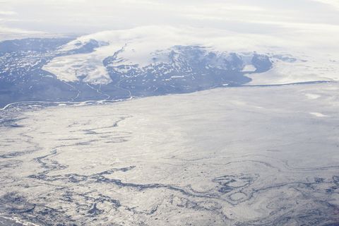
An eruption might start under Dyngjujökull or Bárðarbunga

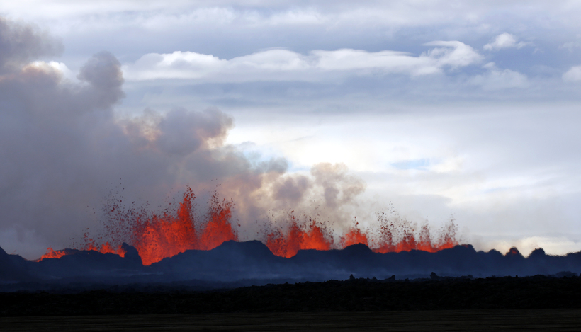
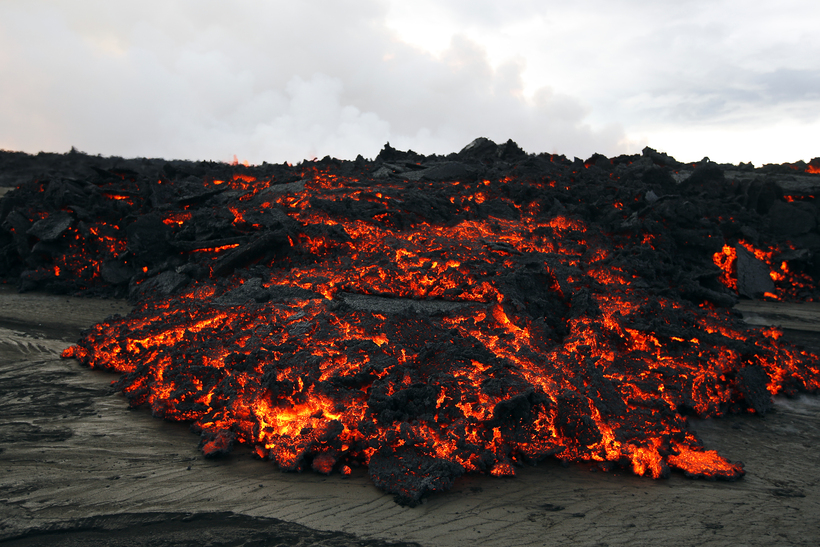
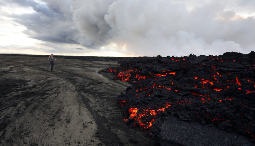
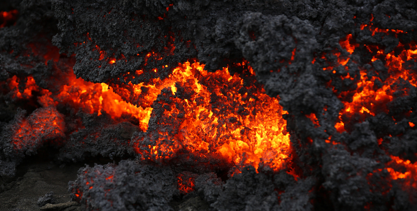
Lava coming from Holuhraun.
Eggert Jóhannesson
Scientists from the Icelandic Met Office and the Institute of Earth Sciences and representatives of the Civil Protection in Iceland attend the meetings of the Scientific Advisory Board of the Icelandic Civil Protection.
These are the key points of the Scientific Advisory Board of the Icelandic Civil
- Seismic activity continues. Around 160 earthquakes have been recorded since midnight UCT today. Seismicity is occurring mostly beneath the northern edge of Dyngjujökull. A magnitude 5.5 earthquake occurred at 03:08 UTC today on the northern side of the Bárðarbunga caldera.
- GPS measurements show that the volume of the dyke intrusion has increased since the beginning of the eruption; this signifies that more magma is entering the dyke than is being erupted.
- Despite no sign of a volume decrease in the dyke, GPS measurements show that the rate of ground deformation has slowed.
- Recent radar images show a 0.5 – 1 km wide depression that has formed both in front of and beneath Dyngjujökull. Signs of the depression extend about 2 km into the ice margin. The increasing thickness of the glacier decreases the visual extent of fracturing associated with the depression, so it is likely that the area extends further beneath Dyngjujökull.
- In light of GPS, radar and seismic results, it is possible that the ongoing eruption could progress southward under Dyngjujökull. This would lead to immediate flooding hazards on the floodplain in front of Dyngjujökull. Consequently, risk assessments for scientists working in the area will be reviewed.
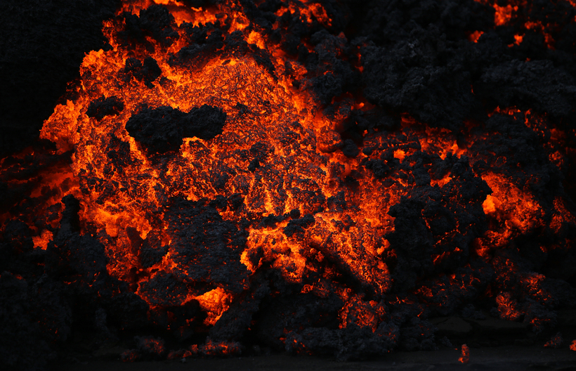
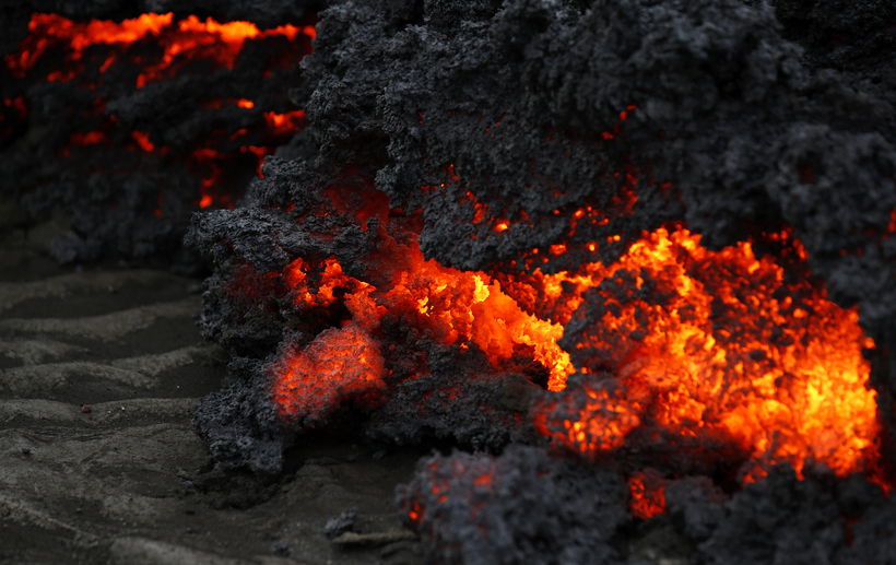
- The volcanic eruption continues on Holuhraun; the main path for lava is to the east-north-east.
- At 08:00 UTC today the total area of the lava flow was estimated at 7.2 km2.
- There have been no observations of ash-fall. Ash production is almost negligible.
- Sulphur dioxide continues to be detected near to the eruption site. The eruption cloud is drifting to the north-east from the eruption site.
An eruption might start under Dyngjujökull or in Bárðarbunga
The following are the four most likely scenarios in the Dyngjujökull-Bárðarbunga area:
- The migration of magma could stop, resulting in a gradual reduction in seismic activity and no further eruptions.
- The dike could reach the Earth’s surface causing another eruption, possibly on a new fissure. Lava flow and (or) explosive activity cannot be excluded.
- The intrusion reaches the surface and another eruption occurs where either the fissure is partly or entirely beneath Dyngjujökull. This would most likely produce a flood in Jökulsá á Fjöllum and perhaps explosive, ash-producing activity.
- An eruption in Bárðarbunga. The eruption could cause an outburst flood and possibly an explosive, ash-producing activity. In the event of a subglacial eruption, it is most likely that flooding would affect Jökulsá á Fjöllum. However it is not possible to exclude the following flood paths: Skjálfandafljót, Kaldakvísl, Skaftá and Grímsvötn.
- Other scenarios cannot be ruled out.
The Aviation Colour Code for Bárðarbunga remains at ‘orange’ and the code for Askja at ‘yellow’.

 „Umsátursástand“
 Kostnaður meiri en milljón á fermetra
 Vonast til að tjaldbúðir við HÍ standi áfram
 Strand skemmtiferðaskips kallar á erlenda aðstoð
 Skaut sex sinnum að feðginum á aðfangadagskvöld
 Telur forsendur fyrir vaxtalækkun
 „Höfum ekki náð að skríða upp úr þeirri gryfju“