Biggest subsidence since measurements of crustal movements started
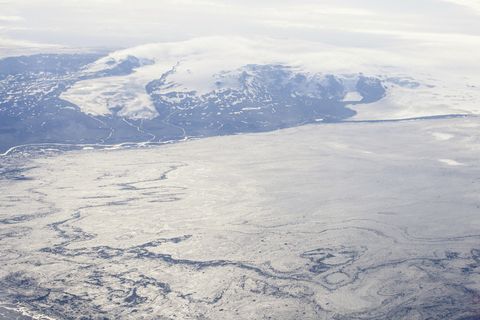
In the surveillance flight yesterday the ice-surface at Bárðarbunga was measured with the radar system of Isavia’s aircraft. The measurements show large changes on the ice-surface. Up to 15 m subsidence has occurred in the centre of the caldera, which corresponds to a volume change of 0.25 km3. The shape of the subsidence area is in accordance with the elevation of the caldera floor having lowered by that amount.
o Subsidence of this order has not been observed in Iceland since measurements of crustal movements started around the middle of last century.
o No signs of eruption or increased geothermal activity in the Bárðarbunga caldera are observed.
o The volume of the subsidence in Bárðarbunga is considerable portion of the total volume of the magma dyke.
o The most probable explanation is that this subsidence is related to the recent high seismic activity and subsurface magma flow to the northeast.
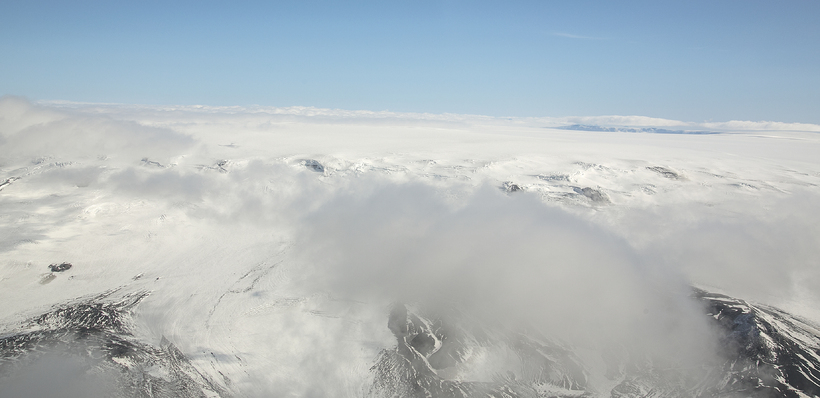
- In the surveillance flight yesterday a shallow, wide depression was observed on the surface of Dyngujökull, 10 km from the glacier edge. Another depression 6 km from the Dyngjujökull ice edge, which has been monitored over the last few days has deepened and is now 35 m deep.
o It is likely that these depressions are sings of small and short sub glacial eruptions.
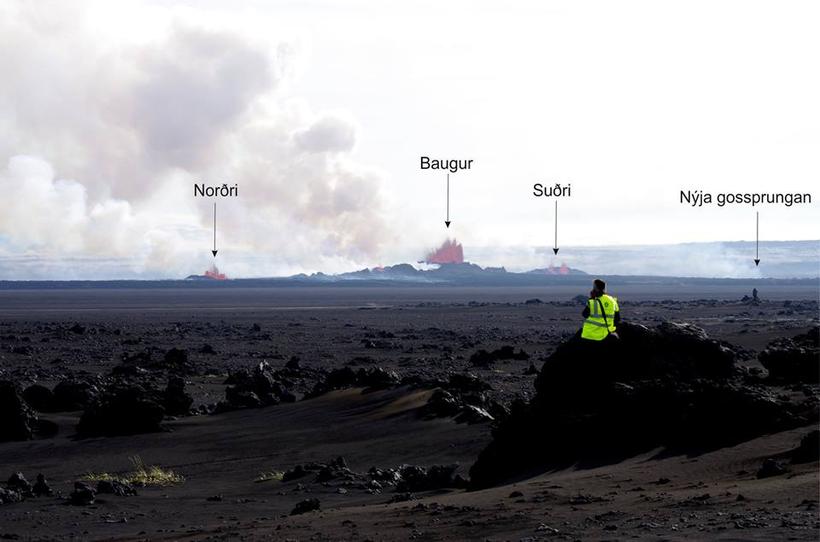
- The eruptive activity at Holuhraun is the same as yesterday.
o Two eruptive fissures are active. The main activity is on the same fissure that has been active since the eruption began. In addition the fissure that opened yesterday morning is still active.
o The lava now extends 10 km ENE and has just under one km to reach Jökulsá á Fjöllum river.
- Seismic activity has decreased since yesterday. Approximately 90 earthquakes have been detected since midnight. One earthquake, of magnitude 5 was located in the Bárðarbunga caldera at 05:40 UTC. 14 earthquakes of magnitudes greater than 5 have been located since 16 of August.
- Deformation changes since yesterday, measured with GPS north of Vatnajökull are small.
- Four scenarios are still likely:
o The migration of magma could stop, resulting in a gradual reduction in seismic activity and no further eruptions.
o The dyke could reach the Earth’s surface at different locations outside the glacier. Lava flow and/or explosive activity cannot be excluded.
o The intrusion again reaches the surface under the glacier and possibly leads to a significant eruption. This would most likely produce a flood in Jökulsá á Fjöllum and perhaps explosive, ash-producing activity.
o An eruption in Bárðarbunga. The eruption could cause an outburst flood and possibly an explosive, ash-producing activity. In the event of a subglacial eruption, it is most likely that flooding would affect Jökulsá á Fjöllum. However it is not possible to exclude the following flood paths: Skjálfandafljót, Kaldakvísl, Skaftá and Grímsvötn.
Other scenarios cannot be excluded.
From the Icelandic Met Office:
The Aviation Colour Code for Bárðarbunga remains at ‘orange’ and the code for Askja at ‘yellow’.